

Sidescan Sonar Data Processing and Interpretation
Sidescan Sonar Data Processing and Interpretation
Published 9/2025
Duration: 2h 54m | .MP4 1280x720 30 fps(r) | AAC, 44100 Hz, 2ch | 2.24 GB
Genre: eLearning | Language: English
Published 9/2025
Duration: 2h 54m | .MP4 1280x720 30 fps(r) | AAC, 44100 Hz, 2ch | 2.24 GB
Genre: eLearning | Language: English
Sidescan Sonar Data Processing and Interpretation with python and other commercial tools
What you'll learn
- Data Acquisition & Import
- Pre-Processing
- Georeferencing
- Mosaicking
- Feature Detection & Enhancement
- Interpretation & Classification
- Reporting & Deliverables
- Quality Control & Validation
Requirements
- Use Pc
- Principal of Acusti and Wave Propagation
Description
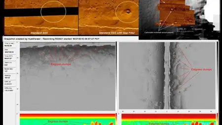
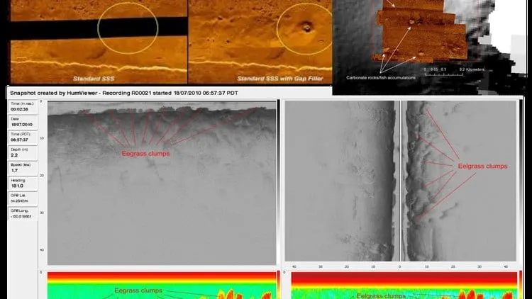
This course provides a comprehensive, hands-on introduction to the complete workflow of sidescan sonar data processing and interpretation, from raw acquisition to the production of high-quality mosaics and detailed seabed maps. Participants will learn how to import and quality-check sonar datasets, apply essential pre-processing techniques such as slant range and beam pattern corrections, remove the water column, and perform precise georeferencing using navigation and motion data.
The training covers best practices for mosaicking survey lines, optimizing overlap and seamlines, and enhancing images for clear target visualization. Students will gain practical skills in identifying and classifying seabed features, including anthropogenic objects (wrecks, debris, pipelines) and natural seabed structures (ripples, scour marks, sediment boundaries). Techniques for shadow-based height estimation, sediment texture mapping, and advanced image enhancement will be included.
Quality control is emphasized, with methods for assessing survey coverage, positional accuracy, and cross-line consistency. The course concludes with guidance on producing professional deliverables such as annotated mosaics, georeferenced target lists, and interpretation reports.
By the end, participants will be equipped to confidently process, analyze, and interpret sidescan sonar data for applications in hydrography, marine archaeology, offshore engineering, and environmental monitoring, with real case history, starting from theory to real image processing, geological / acustical interpretation.
Who this course is for:
- Geology
More Info